
Two hikes in the Tonto National Forest at Hohokam sites
There are so many great trails in and around Scottsdale, Arizona, that we usually hike our favorites close to home. But sometimes we venture further afield to explore more of Arizona and other great hiking spots in beautiful places.
As an update to our previous articles about some of the great hikes we’ve taken, here’s a report on two mostly easy hikes in the Tonto National Forest of Arizona that offer good exercise, great views, and a look at interesting remains of Hohokam Native American history and culture.
Sears-Kay Ruins Trail (near Cave Creek and Carefree)
How to get to there
From Carefree, take Cave Creek Road/Seven Springs Rd./Forest Road (FR) 24 for 14 miles north to Sears-Kay. Look for the entrance to Sears-Kay on the right. There is a small parking lot with a few covered picnic tables.
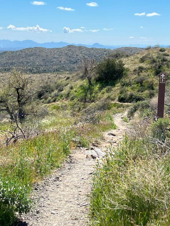
Sears-Kay Ruins Trail
Sears-Kay Ruins Trail Overview
Heading uphill on the Sears-Kay Ruins Trail
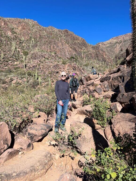
The trail is a 1.6 miles loop. The ruins are perched high on a hill reached by a gentle, but sustained climb (about a 200 ft. elevation gain) on a mostly rocky path with a number of tall steps.
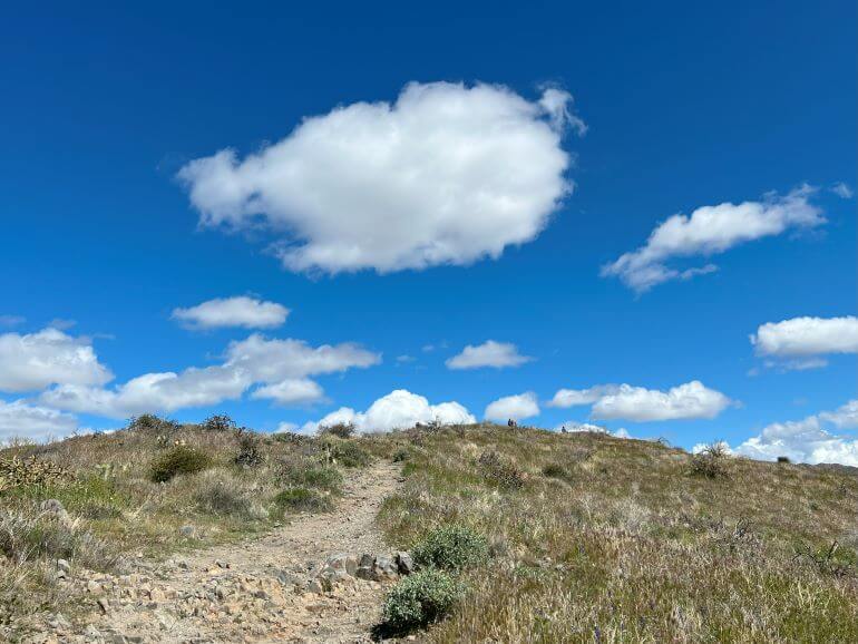
Billowing clouds above the Sears-Kay Ruins
The trail is one to be leisurely enjoyed. Stop to take in the views along the way and appreciate nature.
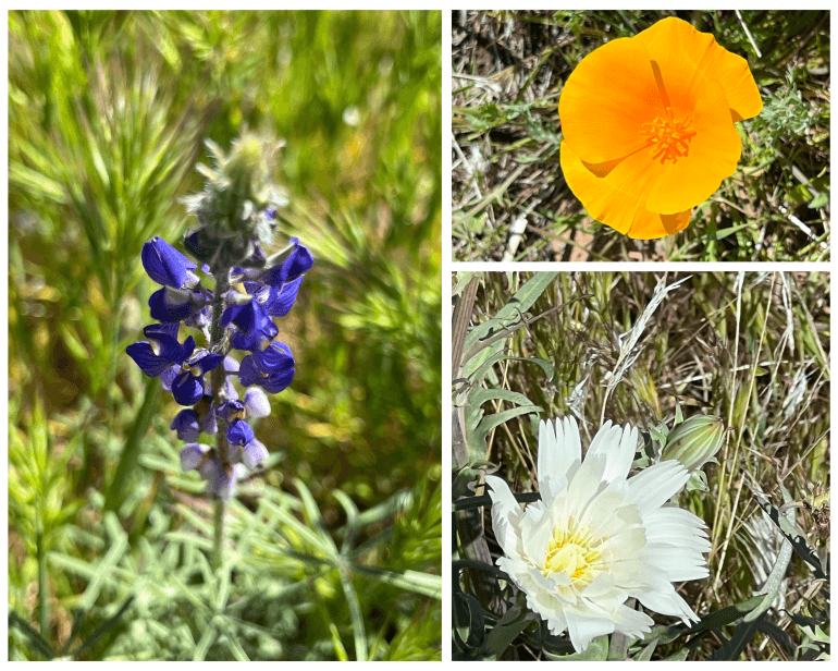
Wildflowers in bloom
During our visit in mid-March, wildflowers were blooming including beautiful Arizona lupine and gold poppies.
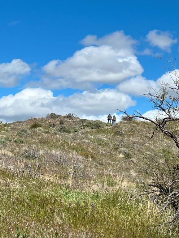
Hikers on top of a hill at Sears-Kay
There were only about a dozen other visitors of all ages that we came across as we walked the loop.
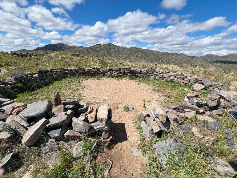
Hohokam village ruins on the Sears-Kay Trail
There are informational signs at several sites explaining the rocky remains of the 40 rooms in 5 compounds as well as Hohokam life. The site of Sears-Kay Ruin dates back about a thousand years and is listed on the National Register of Historic Places.
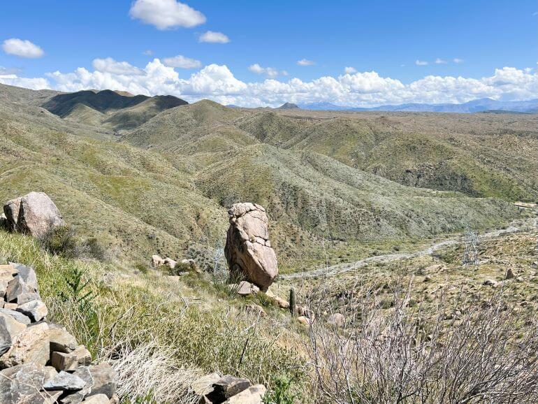
Huge standing rock on the Sears-Kay Ruins Trail
This huge standing rock (photos above and below) on the hillside of Sears-Kay below the ruins is a striking sight as you approach the trail entrance and along the hike. We were eager to get closer to it on the trail.
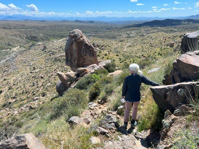
Deciding to turn around on a challenging path
You’ll notice secondary paths off of the main trail at various points. Although most of them are just tame detours, we started to take one that led to the prominent rock we’d seen from a distance, but it turned out to be a little more risky that we liked (steep with uneven rocks and natural steps) so we chose another way.
Dining tip: Heading back west toward Carefree and Cave Creek is a nice, but casual, restaurant and wine bar with indoor and outdoor seating called Ravens View at 42016 N Old Mine Rd on the right side of the road. It’s easy to see going east, but you might miss it going west, so keep an eye open.
Hieroglyphic Trail (Gold Canyon, Arizona)
How to get to there
From Apache Junction (about 12 miles from the trailhead), go east on U.S. 60 toward Globe. Turn left (north) on Kings Ranch Road. At Baseline Avenue, turn right. Take a left on Mohican Road, left on Valley View Drive and right on Cloudview Avenue which leads to the Cloudview Trailhead parking area.
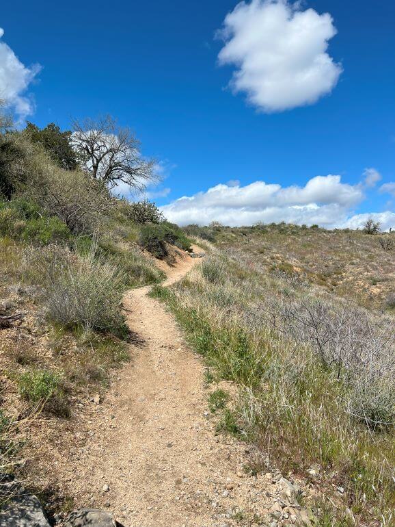
Hieroglyphic Trail
Hieroglyphic Trail overview
From the Cloudview Trailhead parking area, you’ll pass through a gate that leads to the Lost Goldmine Trail (an 11-mile round-trip trail that we have not yet taken) and the Hieroglyphic Trail. Follow the signs and turn left after a few minutes to begin the hike to Hieroglyphic Canyon.
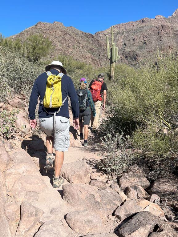
On the Hieroglyphic Trail
The generally wide 1.5 mile (one way) trail is a gentle uphill climb (total elevation gain about 580 ft.) most of the way. Along the way, there is a lot of natural beauty to admire — saguaros, wildflowers, and views of the East Valley below.
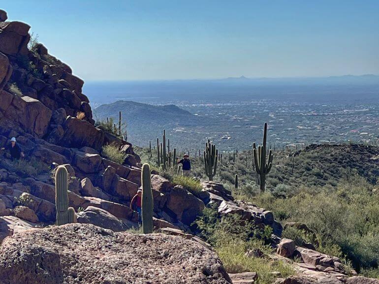
View of the Valley of the Sun from the Hieroglyphic Trail
When you reach the top at Hieroglyphic Canyon, the trail becomes a little more challenging with some big and uneven steps to navigate the boulders.
Once at the top, you’ll see the petroglyphs carved in the stone faces above the seasonal pools. Take note that despite the name of trail, the drawings seen at Hieroglyphics Canyon at the top of the trail are really petroglyphs created by the Hohokam tribe. (Hieroglyphics are Egyptian writings.) Their meaning and significance is not known. The Hohokam Indians lived in this part of the Sonoran Desert about 1,500 years ago.
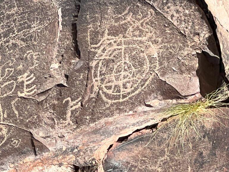
Petroglyphs on the Hieroglyphic Trail
Update April 19, 2024 — You might see experienced hikers scaling the rocks or climbing on the boulders, but please do not attempt this yourself, even if you are an experienced climber. This is a sensitive archaeological site and you may cause damage to the petroglyphs. A commenter on this post put it very well.
This site isn’t listed on the Forest Service site as a climbing site for a reason — it’s a hiking-only site. These carvings have survived for 1000 years, do you really need to be crawling among them and potentially damaging them? — Cindy of explorationvacation.net
Dining tip: Drive into Apache Junction (about 12 miles from trailhead) for lunch or refreshments after your hike. We like the Handlebar Pub and Grill at 650 W Apache Trail. It is a large bar and restaurant with indoor and outdoor seating. Closed Sunday and Monday.
General hiking tips for both trails: Although these hikes are not long or remote, be sure to wear good shoes/boots because of the rough terrain. You might find my packing guide for easy hiking helpful for your hikes.
As with other hiking trails in the area, we don’t hike in summer months when there is extreme heat here in Arizona. We also keep to trails with wide paths when the spring weather warms up and the snakes leave hibernation.
Thank you for sharing the beautiful pictures of Tonto National Forest. I hope you had a great experience there.
I wanted to cry when I saw your post. I visited this site more than 30 years ago and have been scared to go back for exactly the reason I see here: Idiots climbing the petroglyph-covered walls. Please, PLESASE don’t climb amid the petrogyphs and don’t encourage others to do so either. This is completely irresponsible behavior. This site isn’t listed on the Forest Service site as a climbing site for a reason — it’s a hiking-only site. These carvings have survived for 1000 years, do you really need to be crawling among them and potentially damaging them? I’m sure there are other websites with photos of people climbing amid the petroglyphs, but I didn’t see any on the responsible hiking sites I checked and no one suggested climbing here even if there were pictures.
Thank you for your comment, Cindy. You bring up a very important point and I regret that the irresponsibility of climbers at the petroglyphs was lost on me — someone who cares very much about respecting nature, culture, and history. Although I didn’t encourage climbing here (and certainly didn’t myself) I only cautioned others not to climb for safety reasons. I was wrong. You are right that it should be stated that climbing should not be done on or over the petroglyphs. I have updated the post to clearly state that. Thank you for your valuable input.
Thanks for understanding. Always a fan of your site.