
Marcus Landslide Trail — Our latest hike in the Sonoran Desert
After a long period of hiking on our usual favorite Sonoran Desert trails, we decided to try something new. We’d heard a lot about the trails accessed at the Tom’s Thumb Trailhead with most of the input coming from advanced hikers who like to get some good elevation and adventure in their hikes. But we learned that in addition to the more difficult trails, there is a nice moderate one that sounded perfect for us. We’ve now added the Marcus Landslide Trail to our list of favorites.
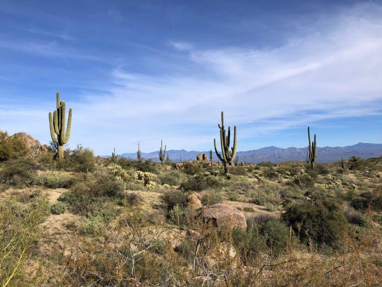
Views of Mazatzal Mountains from the Marcus Landslide Interpretive Trail
Tom’s Thumb Trailhead (23015 N. 128th Street)
Marcus Landslide Trail – Moderately Difficult (Hiking, Biking, Horseback Riding, Climbing)
The Marcus Landslide Trail (so named for the massive landslide discovered there that occurred over 500,000 years ago) is a three-mile round-trip hike with a change in elevation of 280 ft. Much of the grade is gently downhill on the way out, uphill on the way back (with sections of up and down dips). The surface of the often curvy path is quite smooth and wide. At the end of the trail, you can opt to walk an additional .8 miles and go up another 200 ft on the Marcus Landslide Loop at the historic landslide site. Horses and bikes aren’t allowed on the loop — only foot traffic.
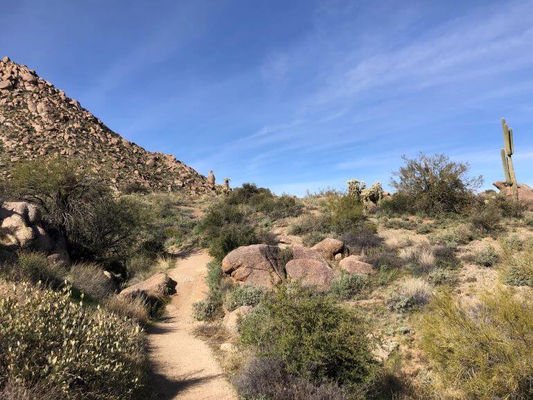
Along the Marcus Landslide Trail
The most direct way to pick up the trail is at the south end of the trailhead parking area. You can retrace your footsteps to return. Starting out, we took a short alternate route from the trailhead going south on Tom’s Thumb Trail, then turning left on the Feldspar Trail until meeting up with Marcus Landslide trail and turning right to continue the main trail. We returned on the main trail.
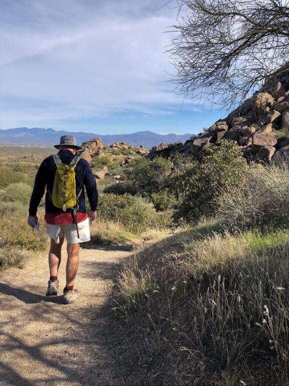
Mr. TWS on the Marcus Landslide Trail with view of mountains to the east
There are beautiful views from all along the trail. Looking eastward across Verde River Valley are the Mazatzal and Superstition Mountains. To the west you’ll see the east side of the McDowell Mountains.

Boulders along the Marcus Landslide Trail
The boulders and other rock formations are stunning and often quite unusual.
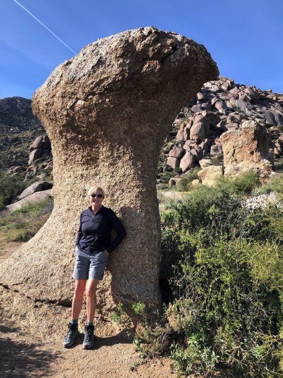
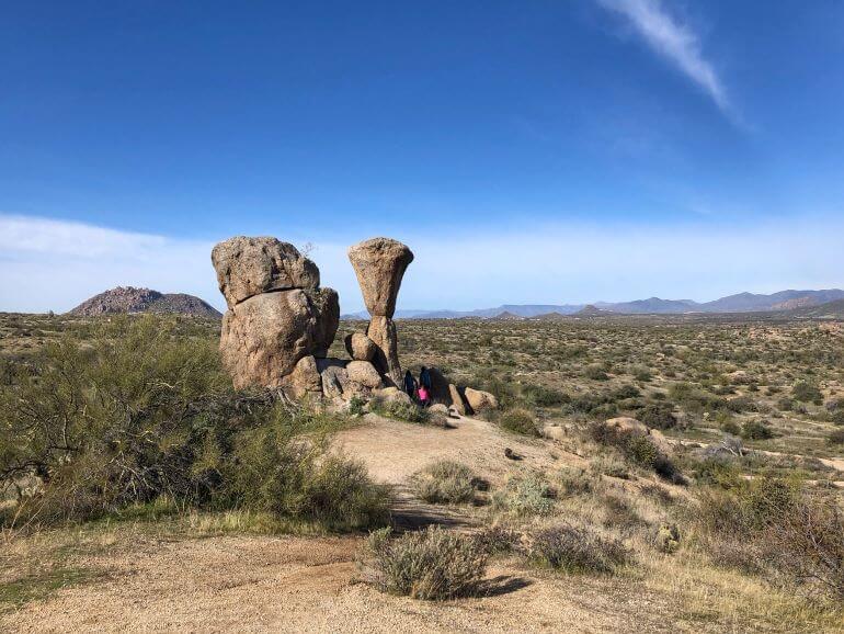
One of many unusual mushroom-shaped rocks on the trail
Marcus Landslide Trail is an interpretive trail with numerous informational signs and vista points. If you’d like to do some rock climbing, watch for the signs for designated easy to moderate rock climbing spots.

Directional and rock climbing access signs
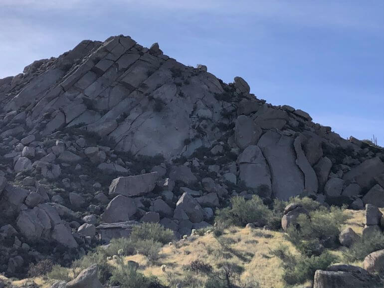
Hikers climbing around rocks atop a hill on the trail
We also caught sight of someone doing some very advanced rock climbing. If you zoom in a bit on the photo below, you’ll see a person about halfway up a large rock surface in the center of the picture. I couldn’t see any ropes, but I assume there was some kind of support. We don’t advise that kind of climbing unless you’re an expert!
Look closely to see a person climbing the rock face
Update January, 2020: We’ve been back to the trail again! On this hike, we were able to get some cool views of snow-capped mountains in the distance (shown below).
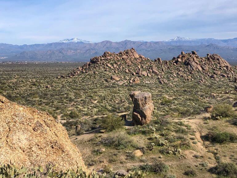
Vista of snow-capped mountains from a hill on the trail
Directions to Tom’s Thumb Trailhead:
From Scottsdale Rd or Pima Rd, turn East onto Happy Valley Rd. Proceed about 2 miles past Alma School and turn right (East) onto Ranch Gate. Proceed to the end of Ranch Gate and then turn right (South) onto 128 St and you’ll arrive at the trailhead in less than a mile. — McDowell Sonoran Conservancy
Tom’s Thumb tips:
- There are two large parking areas and an area for equestrian parking.
- There is a building with restrooms at the trailhead.
- Bring plenty of water for your hike because there is no water available at the trailhead.
- Other hiking trails from the trailhead include the Tom’s Thumb, Feldspar, Mesquite Canyon Loop (an easy 1.1 mi loop) and Tom’s Thumb Trail (to the base of Tom’s Thumb), a difficult 4.6 mi round trip.
- Because of road construction on 128th Street (as of December 2019), the road is narrow from Ranch Gate Road to the trailhead, so be careful and courteous of oncoming vehicles.
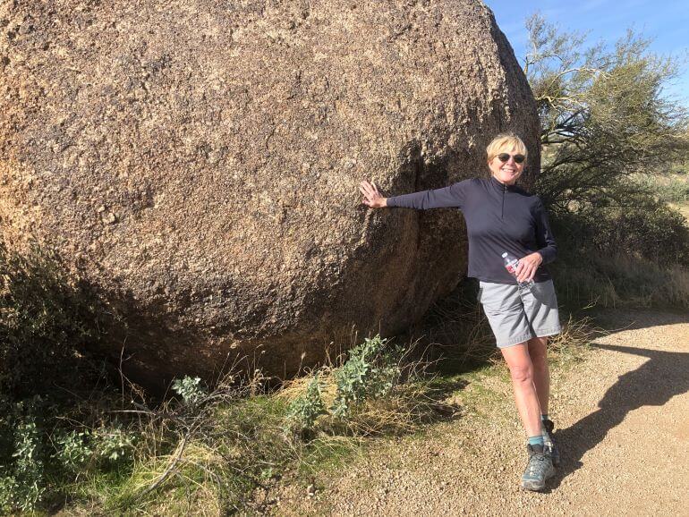
One of the giant boulders along the trail
More of our favorite Scottsdale hikes
Past articles where you can find more information about Scottsdale hiking trails:
Our Top 5 Scottsdale Hikes … So Far
Granite Mountain Trailhead (31402 N. 136th Street)
Bootlegger Trail – Moderate (Hiking, Biking, Horseback Riding)
Lost Dog Wash Trailhead (12601 N. 124th Street)
Lost Dog Wash Trail connecting with Ringtail Trail – Easy (Hiking, Biking, Horseback Riding)
Gateway Trailhead (18333 N. Thompson Peak Parkway)
Gateway Loop Trail – Moderate (Hiking, Biking, Horseback Riding)
Quartz Trailhead (10215 E. McDowell Mountain Ranch Road)
Quartz Trail — Easy (Hiking, Biking, Horseback Riding)
Sunrise Trailhead (12101 N. 145th Way)
Sunrise Trail –Difficult (Hiking, Biking, Horseback Riding)
More Scottsdale Hikes: Paradise and Brown’s Ranch Road Trails
Gateway Trailhead (18333 N. Thompson Peak Parkway)
Paradise Trail — Easy (Hiking, Biking, Horseback Riding)
Brown’s Ranch Trailhead (30301 N. Alma School Parkway)
Brown’s Ranch Road Trail — Easy (Hiking, Biking, Horseback Riding)
Easy Hiking and Biking in Scottsdale
104th and Bell Trailhead (Bell Road east of Thompson Peak Parkway)
104th Street Trail and Levee Trail — Easy (Hiking, Biking, Horseback Riding)
Happy Hiking!
PIN this post for later!

You guys sure have explored the area. What stunning views on Tom Thumb’s Trailhead.
The Marcus Landslide Trail looks like a great place for hiking – what wonderful views!
Pingback: Seeing 2020 by Looking Back | Traveling with Sweeney
Tom’s Thumb looks like a great trail – nice to see one that has great views and isn’t too difficult!
I just got some new hiking boots so can’t wait to hike somewhere like Marcus Landslide Trail! Those views are stunning and the trail itself doesn’t look too rugged for a newbie like me.
What a great place to take an extended stroll. We love the interesting formations that dot the landscape and add extra interest to the hike. Looks like we need to get going to Scottsdale.
Pingback: Adventures and Misadventures in Antigua | Traveling with Sweeney